Public Safety and Disaster Relief
“The data from the Southern California Integrated GPS Network will allow us to anticipate future earthquakes with more accuracy, as well as to study in much greater detail the fundamental processes of crustal deformation that are the root causes of earthquakes.”
Dr. Thomas Jordan, Director Designate, Southern California Earthquake Center
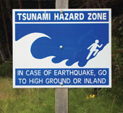
GPS can be used to deliver disaster relief to areas in less time, and more accurately. They can also be used to detect possible dangers in the area (incoming tsunami, wars, etc.). This can save lives and restore infrastructure which was possibly destroyed (i.e. cable lines, hydro-poles, etc.). They can also provide position information for the mapping of disaster regions where ones are not established already. This can become useful for knowing high impact areas, groups who need rescuing, etc. GPS can also be used for the detection of floods, monitoring of seismic precursors, events, etc. Lastly, they can provide positional information about civilians in need/in case of emergency. This is through the civilians’ phones, computers, cars, etc. which contain GPS receivers (mostly).

GPS and Kinematics by Simarjeet Singh Thind is licensed under a Creative Commons Attribution-NonCommercial-ShareAlike 4.0 International License.
Based on a work at http://www.gps.gov/.
